Swift Island Boating Access Area
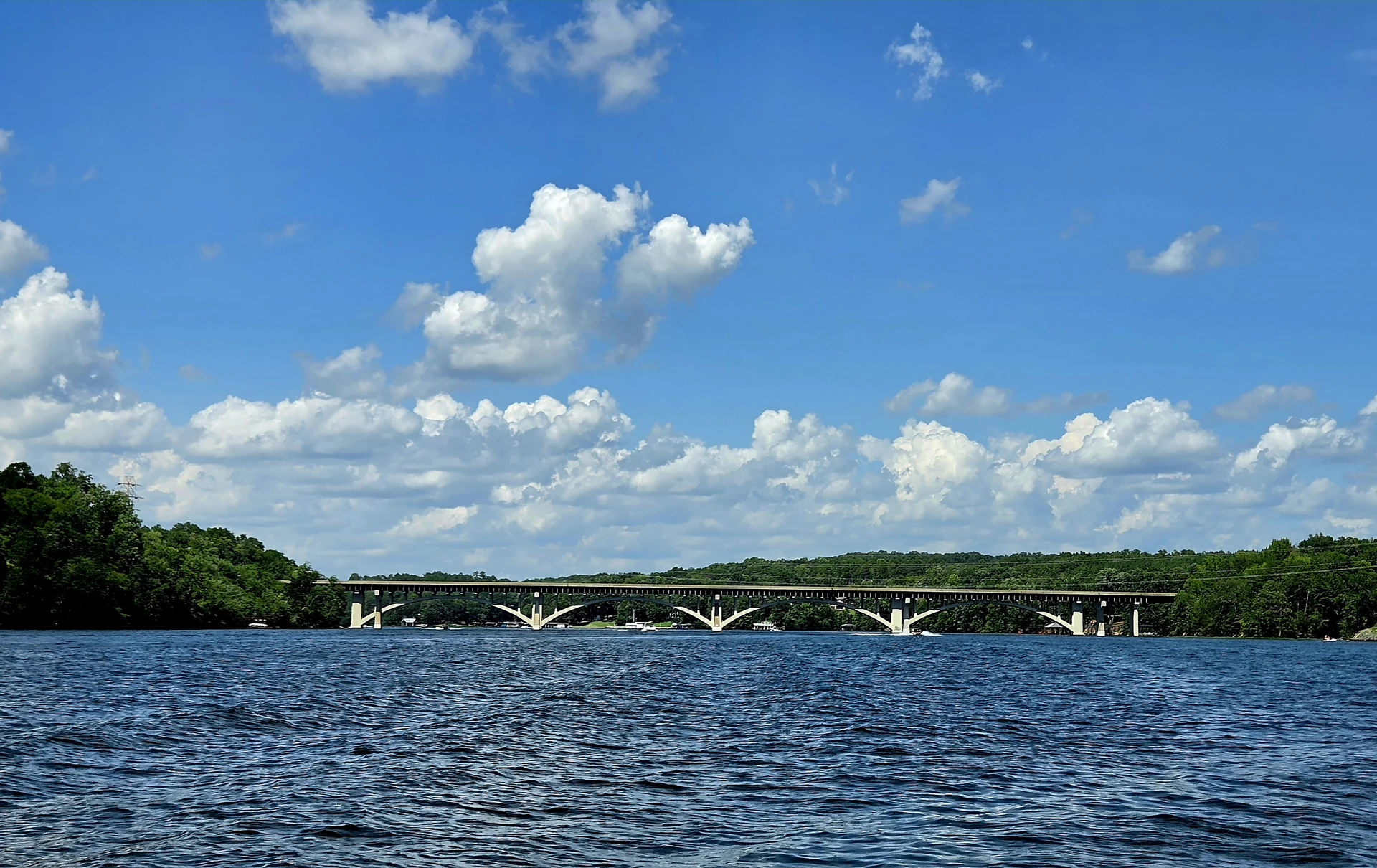
Public Tillery launch beside NC 24/27. Check the low-bridge guidance for leaving the cove.
4917 NC Highway 24/27, Mount Gilead, NC 27306
Find your way around Lake Tillery before choosing the day. Compare the west and east shores, public launches and nearby towns, then follow the guide for a boat outing, a walk at Morrow Mountain or time on shore.
Two lakes, nearby towns, different entrances. Choose a numbered stop or its matching list entry to see where to arrive.
Choose the actual public launch, park waterfront or rental meeting point. A marina dock and a public trailer launch are separate arrivals.
A park walk or summit stop, Badin’s company-town history and Albemarle food or indoor galleries. Badin’s own waterfront is on Badin Lake.
Town Creek’s outdoor mound and village, a meal in Mount Gilead and a town park. The visitor center and gift shop remain closed.
Main Street food and coffee, a town walk or Piney Point golf, with Norwood Access as a separate lake stop. Check museum opening hours before visiting.
Select a designated trailhead, bike area, horse camp or OHV entrance, then add a Troy meal. Each activity has different permitted routes.
Look beyond the lake to Star, Candor, Biscoe and other reviewed outings. A county filter is a place search, not permission to enter private facilities.
Look for major regional events and established historic attractions beyond the lake towns. For food, shops and everyday services, start with Badin, Albemarle or Norwood.
Lake Tillery lies in central North Carolina's Piedmont, along the Stanly–Montgomery county line. Norwood is the practical town for the west and southwest side of the lake, while Mount Gilead serves the east and south-lake side. Morrow Mountain State Park at the upper lake is about 50 miles northeast of Charlotte; here, Lake Tillery sits within the Yadkin–Pee Dee river system.
Lake Tillery covers about 5,261 acres and winds along roughly 104 miles of shoreline. NC Wildlife's reservoir assessment and Visit Stanly provide those useful measures of its scale.
This is a working hydroelectric reservoir, operated by Duke Energy. The lake-level page shows the dated pool-elevation reading and its reference point. Pool elevation is different from water depth at a dock, launch or spot on the lake.

Lake Tillery at the Uwharrie–Pee Dee confluence — Bz3rk · Cropped and resized.
CC BY-SA 4.0Morrow Mountain State Park sits beside the upper lake on the Stanly County side. Farther south, the NC 24/27 crossing and Swift Island access make a recognizable middle-lake reference. Lilly's Bridge and the Norwood–Mount Gilead area orient a south-lake visit. Tillery Dam marks the downstream end.
Lake Tillery belongs to the Yadkin–Pee Dee river system. Badin Lake and Falls Reservoir are separate waters nearby. That distinction matters when booking a campsite or finding a boat ramp: a Uwharrie Lakes address does not always mean Lake Tillery.
Norwood is a west-side stop for south-lake food, supplies and Piney Point golf. Its museum sits beside the library on Pee Dee Avenue. A town visit and a launch at Norwood Access are separate arrivals, even when both fit the same day.
Mount Gilead lies east of Tillery. Downtown food and the town museum pair with Town Creek Indian Mound farther south; a boating day instead takes you toward Lilly's Bridge or another named access. A Mount Gilead mailing address alone does not mean waterfront.
Albemarle has a wider choice of restaurants, hotels and indoor stops, including the Stanly County History Center. It works as a town base for Morrow Mountain or a west-shore outing, with the lake a separate drive from downtown.
Badin brings company-town history and museums into a Morrow Mountain visit. Its own waterfront is on Badin Lake, not Tillery. That distinction matters when following directions to a beach, boat landing or lodging.
Troy lies inland on the Montgomery County side. The Discover Uwharrie Welcome Center and forest trailheads suit a land-focused day; Capel Centennial Park and a dated TownStage concert can give you a reason to stay in town after the walk.
Tillery has generated hydroelectric power since 1928. The rising reservoir would flood the site of a Pee Dee River bridge completed in 1922, so the concrete-arch Swift Island Ferry Bridge—also called the James B. Garrison Bridge—was built in 1927–28 as its replacement.
Before the older bridge site was inundated, the military used that 1922 span for a widely reported demolition exercise. NCDOT's historical assessment records 350 tons placed on the deck, aerial and artillery attacks, Metro-Goldwyn filming, and the final use of 2,000 pounds of TNT at the piers. What is documented is the bridge—not a lost Tillery town.
The replacement's arches remain a recognizable part of Tillery's landscape. Town Creek and the town museums tell older and different regional stories; they are worthwhile stops beyond the reservoir's history.
Morrow Mountain puts trails, an overlook and lake access in one park. Uwharrie National Forest is a larger trip with separate trailheads and recreation areas. Its general map marker is useful for orientation; a walk needs directions to the actual trailhead.
A lake outing followed by a nearby meal leaves more of the day outdoors. For a longer forest walk as well, consider an overnight trip instead of trying to cover the lake, forest and several towns in one afternoon.
The park, Town Creek, a town museum or a local event can be the reason for a visit. A boat rental is another possibility, booked separately around the weather. Public ramps are for launching, not a substitute for a public swimming beach.
Choose a few stops that fit the same side of the lake, then check weather and lake level when the day depends on conditions at the water.
Have a lake or outdoor photograph to contribute? Send it privately for review →